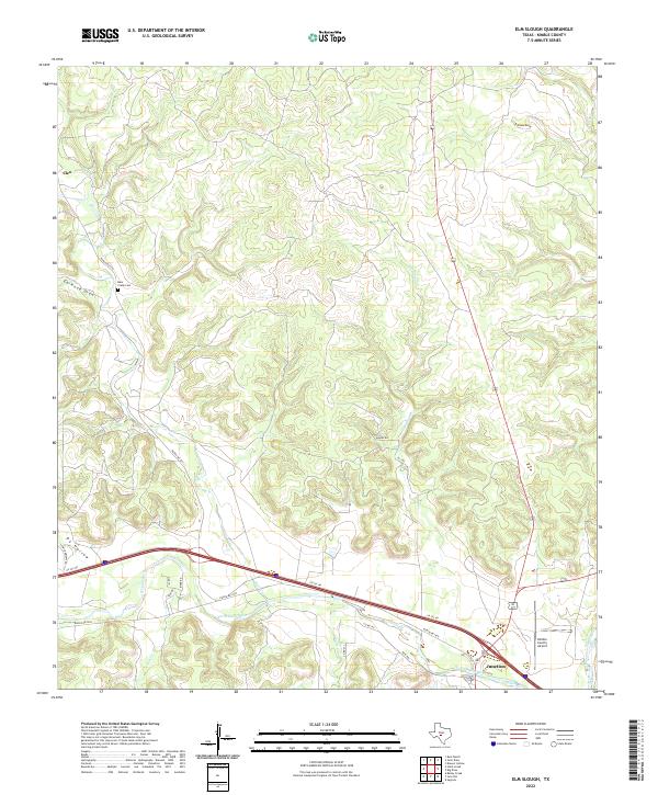
2022 Map of Elm Slough
USGS Topo · Published 2022About this map
Junction and the small settlement of Cleo anchor this study of the Texas Hill Country, where the modern path of Interstate 10 follows the southern curves of the North Llano River. The landscape is defined by its drainage patterns, with deep incisions from Earwood Draw and Gorman Draw feeding into the winding courses of Bear Cr and Elm Slough. This network of seasonal and perennial water defines the local ranching layout, indicated by the network of local routes like Ranch Rd 2291 and Co Rd 190.
Find a feature on this map
26 named features on this map. Tap any name to fly to it.
Don’t see what you’re looking for? This feature index may not catch every label — zoom into the map to look around manually.
Map Details
Editions of this 2022 Elm Slough Map
This is the sole edition of this map. No revisions or reprints were ever made.
Other maps of this area

1932 · Junction
USGS Topo · 1:62,500

1954 · Llano
USGS Topo · 1:250,000

1955 · Llano
USGS Topo · 1:250,000

1956 · Llano
USGS Topo · 1:250,000

1970 · Julio Draw
USGS Topo · 1:24,000
1970 · Rust Ranch
USGS Topo · 1:24,000

1970 · Brewer Hollow
USGS Topo · 1:24,000

1970 · Elm Slough
USGS Topo · 1:24,000
1970 · Stark Creek
USGS Topo · 1:24,000
1970 · Big Draw
USGS Topo · 1:24,000