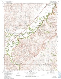
1989 Map of Elmdale
USGS Topo · Published 1990About this map
The Cottonwood River meanders across this Chase County landscape, defining the character of the tallgrass prairie region in the late twentieth century. Centered around the small settlements of Elmdale and Clements, the map illustrates a rural economy transitioning from traditional agriculture to specialized land use, evidenced by the Elmdale Gas Field and the sprawling grounds of Camp Wood. The intricate hydrology of the area is well-documented, with tributaries like Diamond Creek, Silver Creek, and Holmes Creek carving deep drainage patterns into the surrounding uplands.
Find a feature on this map
20 named features on this map. Tap any name to fly to it.
Don’t see what you’re looking for? This feature index may not catch every label — zoom into the map to look around manually.
Map Details
Editions of this 1989 Elmdale Map
This is the sole edition of this map. No revisions or reprints were ever made.
Other maps of this area

1898 · Cottonwood Falls
USGS Topo · 1:125,000

1955 · Hutchinson
USGS Topo · 1:250,000

1957 · Elmdale
USGS Topo · 1:24,000

1957 · Strong City
USGS Topo · 1:24,000

1957 · Wonsevu
USGS Topo · 1:24,000

1957 · Cedar Point
USGS Topo · 1:24,000

1957 · Hymer
USGS Topo · 1:24,000

1959 · Hutchinson
USGS Topo · 1:250,000

1970 · Lincolnville NE
USGS Topo · 1:24,000

1973 · Matfield Green
USGS Topo · 1:24,000