
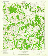
1953 Map of Elmendorf
USGS Topo · Published 1959About this map
The Southern Pacific railroad cuts a diagonal path through the southeastern corner of Bexar County, anchoring the town of Elmendorf. In the early 1950s, this landscape was defined by its transition from agricultural creek bottoms to active petroleum extraction, with both the Eckert Oil Field and Lone Oak Oil Field marked by numerous oil wells and oil tanks. The drainage networks of Honda Creek and Calaveras Creek create a rolling topography where small settlements like Utzville and Sayers are situated.
Find a feature on this map
23 named features on this map. Tap any name to fly to it.
Don’t see what you’re looking for? This feature index may not catch every label — zoom into the map to look around manually.
Map Details
Editions of this 1953 Elmendorf Map
This is the sole edition of this map. No revisions or reprints were ever made.
Other maps of this area

1936 · Floresville
USGS Topo · 1:62,500

1953 · San Antonio East
USGS Topo · 1:24,000

1953 · Southton
USGS Topo · 1:24,000

1953 · Martinez
USGS Topo · 1:24,000

1954 · San Antonio
USGS Topo · 1:250,000

1957 · San Antonio
USGS Topo · 1:250,000

1958 · Losoya
USGS Topo · 1:24,000

1958 · La Vernia SW
USGS Topo · 1:24,000

1958 · Saspamco
USGS Topo · 1:24,000
1958 · Saint Hedwig
USGS Topo · 1:24,000