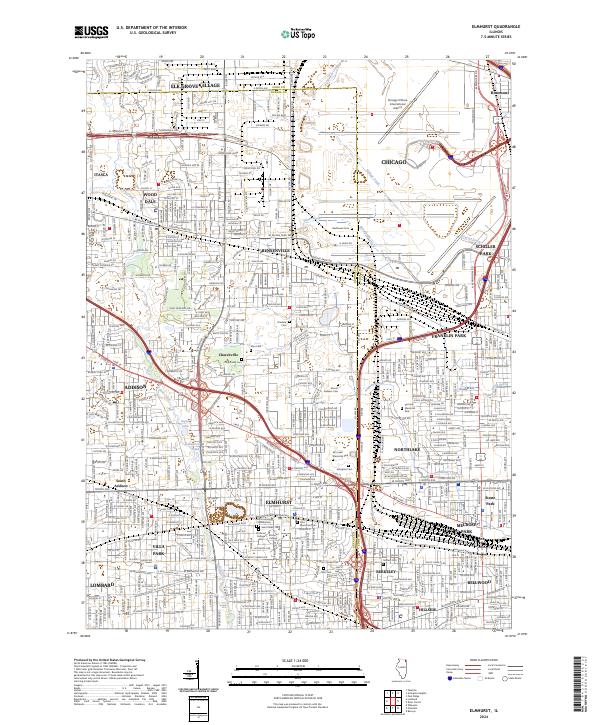
2024 Map of Elmhurst
USGS Topo · Published 2024About this map
Elmhurst serves as a central hub in this contemporary look at the western Chicago suburbs, where dense residential grids meet critical transit infrastructure. The map documents a mature suburban landscape defined by its connection to Chicago O'Hare International Airport, which occupies the northeast corner, and a complex network of thoroughfares like W Irving Park Rd and W North Ave. Genealogists and local historians will find significant detail in the concentration of memorial sites, including Saint Mary Cem and Cremation Columbarium, Mount Emblem Cem, and the historic Churchville Cem near the Churchville settlement.
Find a feature on this map
79 named features on this map. Tap any name to fly to it.
Don’t see what you’re looking for? This feature index may not catch every label — zoom into the map to look around manually.
Map Details
Editions of this 2024 Elmhurst Map
This is the sole edition of this map. No revisions or reprints were ever made.
Other maps of this area

1891 · Riverside
USGS Topo · 1:62,500

1893 · Riverside
USGS Topo · 1:62,500

1900 · Riverside
USGS Topo · 1:62,500

1900 · Highwood
USGS Topo · 1:62,500

1901 · Riverside
USGS Topo · 1:62,500

1908 · Wheaton
USGS Topo · 1:62,500

1923 · Barrington
USGS Topo · 1:62,500
1927 · Hinsdale
USGS Topo · 1:24,000

1927 · Arlington Heights
USGS Topo · 1:24,000

1928 · Elmhurst
USGS Topo · 1:24,000