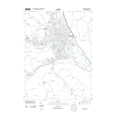
2013 Map of Elmira
USGS Topo · Published 2013About this map
Elmira College and the surrounding urban grid of Elmira define the northern portion of this Chemung River valley study. The landscape is notably marked by significant memorial sites, including the expansive Woodlawn National Cemetery and Woodlawn Cemetery, which provide deep historical roots for the community. Residential developments like the Hoffman Plaza Housing Project and Hathorn Court reflect mid-century growth patterns, while institutions such as the Elmira Business Institute anchor the commercial core.
Find a feature on this map
263 named features on this map. Tap any name to fly to it.
Don’t see what you’re looking for? This feature index may not catch every label — zoom into the map to look around manually.
Map Details
Editions of this 2013 Elmira Map
This is the sole edition of this map. No revisions or reprints were ever made.
Other maps of this area

1895 · Elmira
USGS Topo · 1:62,500

1902 · Waverly
USGS Topo · 1:62,500

1905 · Watkins Glen
USGS Topo · 1:125,000

1931 · Troy
USGS Topo · 1:48,000

1938 · Troy
USGS Topo · 1:62,500

1939 · Sayre
USGS Topo · 1:62,500

1942 · Sayre
USGS Topo · 1:62,500

1948 · Sayre
USGS Topo · 1:62,500

1950 · Elmira
USGS Topo · 1:250,000
1953 · Horseheads
USGS Topo · 1:24,000