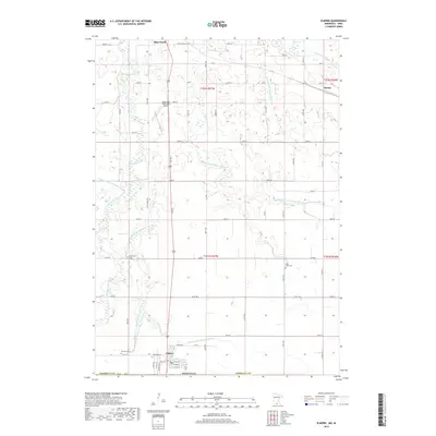
2019 Map of Elmore
USGS Topo · Published 2019About this map
Blue Earth and Elmore anchor this section of Faribault County, where the southern Minnesota prairie meets a complex system of hydraulic engineering. The landscape is defined by the convergence of the W Br Blue Earth River and Middle Br Blue Earth River, supplemented by an extensive network of drainage projects such as Judicial Ditch Number Seven and County Ditch Number Forty-one. These features illustrate the transformation of the regional watershed to support the intensive agriculture surrounding the small settlement of Marna. Local history is preserved in several rural burial grounds, including Dobson Cem, Riverview Cem, and Saint Johns Cem. The northern portion of the map is marked by the Blue Earth Municipal Airport and the meandering path of Coon Cr, providing a detailed look at the infrastructure and natural waterways as they appeared in 2019.
Find a feature on this map
48 named features on this map. Tap any name to fly to it.
Don’t see what you’re looking for? This feature index may not catch every label — zoom into the map to look around manually.
Map Details
Editions of this 2019 Elmore Map
This is the sole edition of this map. No revisions or reprints were ever made.
Other maps of this area

1954 · Fairmont
USGS Topo · 1:250,000

1954 · Mason City
USGS Topo · 1:250,000

1955 · Bricelyn
USGS Topo · 1:62,500

1957 · Mason City
USGS Topo · 1:250,000

1958 · Mason City
USGS Topo · 1:250,000

1958 · Fairmont
USGS Topo · 1:250,000

1967 · Pilot Grove
USGS Topo · 1:24,000

1967 · Elmore
USGS Topo · 1:24,000

1967 · Huntley
USGS Topo · 1:24,000
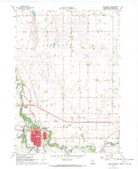
1967 · Blue Earth
USGS Topo · 1:24,000