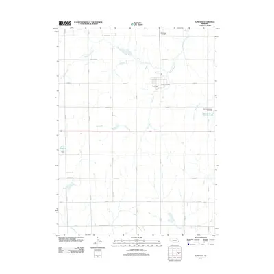
2011 Map of Elmwood
USGS Topo · Published 2011About this map
Elmwood serves as the primary hub for this agricultural portion of Cass County, positioned at the intersection of a vast grid of county roads. The settlement is anchored by the Elmwood Post Office, while the surrounding landscape is defined by the drainage systems of Weeping Water Creek to the north and the North Fork Little Nemaha River to the southeast. Water management is a significant theme across the township, evidenced by several man-made features such as Weyers Reservoir, Wilson Creek Reservoir 12-25, and the Grade Stabilization Dam 12-25. This rural infrastructure supports a patchwork of farmsteads connected by named routes like Fletcher Ave and McMillian Market Rd. Local history researchers will find the Pleasant Hill Cemetery in the southern portion of the quadrangle, and aviation interest is represented by the Bornemeier Airstrip located north of the town center.
Find a feature on this map
42 named features on this map. Tap any name to fly to it.
Don’t see what you’re looking for? This feature index may not catch every label — zoom into the map to look around manually.
Map Details
Editions of this 2011 Elmwood Map
This is the sole edition of this map. No revisions or reprints were ever made.
Other maps of this area

1903 · Weeping Water
USGS Topo · 1:125,000

1929 · Weeping Water
USGS Topo · 1:125,000

1955 · Lincoln
USGS Topo · 1:250,000

1957 · Lincoln
USGS Topo · 1:250,000

1958 · Lincoln
USGS Topo · 1:250,000
1966 · Greenwood
USGS Topo · 1:24,000
1966 · Murdock
USGS Topo · 1:24,000
1966 · Eagle
USGS Topo · 1:24,000
1966 · Palmyra
USGS Topo · 1:24,000
1966 · Elmwood
USGS Topo · 1:24,000