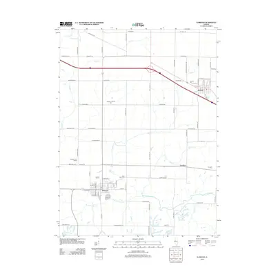
2012 Map of Elmwood
USGS Topo · Published 2012About this map
Elmwood and Brimfield anchor this prairie landscape in western Peoria County, where agricultural patterns are shaped by a series of south-flowing waterways. The W Fork Kickapoo Cr and Tiber Cr carve across the terrain, flanked by numerous burial grounds including Saint Marys Cem, Lehigh Cem, and the Southport Cem near the small community of Southport. The map illustrates a modern infrastructure of aviation and transport, featuring the Shissler Landing Strip and Shissler Farm Airport set amidst a rigid grid of rural roads like N Bell School Rd and N McClellan Rd. This 2012 survey captures the area as it maintains its agrarian identity while supporting small-town centers and regional travel via the interstate corridor passing north of Brimfield.
Find a feature on this map
74 named features on this map. Tap any name to fly to it.
Don’t see what you’re looking for? This feature index may not catch every label — zoom into the map to look around manually.
Map Details
Editions of this 2012 Elmwood Map
This is the sole edition of this map. No revisions or reprints were ever made.
Other maps of this area

1912 · Canton
USGS Topo · 1:62,500

1930 · Glasford
USGS Topo · 1:62,500

1941 · Maquon
USGS Topo · 1:62,500

1943 · Maquon
USGS Topo · 1:62,500

1944 · Elmwood
USGS Topo · 1:62,500

1948 · Elmwood
USGS Topo · 1:62,500

1948 · Glasford
USGS Topo · 1:62,500

1958 · Burlington
USGS Topo · 1:250,000

1958 · Peoria
USGS Topo · 1:250,000

1961 · Burlington
USGS Topo · 1:250,000