
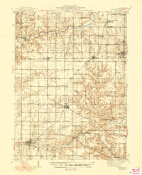
1948 Map of Elmwood
USGS Topo · Published 1948About this map
The Spoon River meanders across the northern reaches of this Illinois landscape, which was surveyed shortly after World War II. The region is defined by a dense network of local township schools such as Nightingale Sch and Scotland Sch, reflecting a rural educational system still anchored by one-room schoolhouses before the era of widespread consolidation. Three major railroads—the Chicago and North Western, the Atchison Topeka and Santa Fe, and the Chicago Burlington and Quincy—crisscross the prairie, connecting agricultural hubs like Princeville and Brimfield. In the eastern section, Jubilee College State Park preserves a pocket of early educational history, while the map records numerous family-oriented landmarks such as Paradise Chapel and the Oak Hill and Cem, which serve as vital reference points for researchers exploring the social geography of the late 1940s.
Find a feature on this map
72 named features on this map. Tap any name to fly to it.
Don’t see what you’re looking for? This feature index may not catch every label — zoom into the map to look around manually.
Map Details
Editions of this 1948 Elmwood Map
2 editions found
Other maps of this area

1893 · Dunlap
USGS Topo · 1:62,500

1898 · Dunlap
USGS Topo · 1:62,500

1905 · Peoria
USGS Topo · 1:62,500

1912 · Canton
USGS Topo · 1:62,500

1927 · Peoria
USGS Topo · 1:62,500

1930 · Glasford
USGS Topo · 1:62,500

1931 · Galva
USGS Topo · 1:48,000

1932 · Dunlap
USGS Topo · 1:62,500

1933 · Dunlap
USGS Topo · 1:62,500

1933 · Camp Grove
USGS Topo · 1:48,000