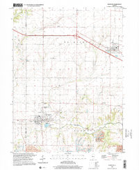
1998 Map of Elmwood
USGS Topo · Published 2001About this map
Elmwood and Brimfield anchor this Peoria County landscape, appearing here as established agricultural and residential centers. The town of Elmwood is particularly detailed, showing the layout of Sweetwater Park and proximity to the Maple Lane Country Club. To the south, the industrial footprint of the region is evident through an extensive Strip Mine operation near Lehigh Cemetery, showing how resource extraction coexists with the rural drainage of the West Fork Kickapoo Creek.
Find a feature on this map
33 named features on this map. Tap any name to fly to it.
Don’t see what you’re looking for? This feature index may not catch every label — zoom into the map to look around manually.
Map Details
Editions of this 1998 Elmwood Map
This is the sole edition of this map. No revisions or reprints were ever made.
Other maps of this area

1912 · Canton
USGS Topo · 1:62,500

1930 · Glasford
USGS Topo · 1:62,500

1941 · Maquon
USGS Topo · 1:62,500

1943 · Maquon
USGS Topo · 1:62,500

1944 · Elmwood
USGS Topo · 1:62,500

1948 · Elmwood
USGS Topo · 1:62,500

1948 · Glasford
USGS Topo · 1:62,500

1958 · Burlington
USGS Topo · 1:250,000

1958 · Peoria
USGS Topo · 1:250,000

1961 · Burlington
USGS Topo · 1:250,000