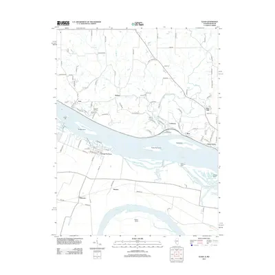
2012 Map of Elsah
USGS Topo · Published 2012About this map
The Mississippi River and Missouri River converge along this stretch of the river valley, shaping a complex landscape of islands and shifting bars. The historic riverfront village of Elsah remains a focal point on the Illinois side, characterized by its position near Principia College. Across the water in Missouri, the community of Portage Des Sioux sits on the narrow peninsula between the two great rivers, surrounded by agricultural tracts and landmarks like Whitecorn and Machens. Numerous family and parish cemeteries, including Wendle Cem, Saint Michaels Cem, and Saint Francis Cem, are scattered across the bluffs, offering a dense record of the region’s local heritage. The interior terrain is dissected by waterways like Piasa Cr and Mill Cr, which create the deep ravines that define the local geography north of Clifton Terrace and Lockhaven.
Find a feature on this map
109 named features on this map. Tap any name to fly to it.
Don’t see what you’re looking for? This feature index may not catch every label — zoom into the map to look around manually.
Map Details
Editions of this 2012 Elsah Map
This is the sole edition of this map. No revisions or reprints were ever made.
Other maps of this area

1924 · Robertson
USGS Topo · 1:24,000

1925 · Brighton
USGS Topo · 1:62,500

1927 · Alton
USGS Topo · 1:62,500

1927 · St. Charles
USGS Topo · 1:62,500

1928 · Brighton
USGS Topo · 1:62,500

1930 · Jerseyville
USGS Topo · 1:62,500

1933 · Jerseyville
USGS Topo · 1:62,500

1933 · Saint Charles
USGS Topo · 1:62,500

1934 · Alton
USGS Topo · 1:62,500

1935 · Florissant
USGS Topo · 1:24,000