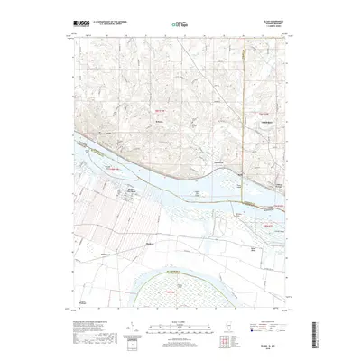
2018 Map of Elsah
USGS Topo · Published 2018About this map
Principia College occupies the dramatic limestone bluffs overlooking the Mississippi River, a defining feature of this borderland between Illinois and Missouri. The terrain is deeply incised by drainages like Mill Cr and Askeu Br, which cut through the uplands toward the river valley. On the Missouri side, the floodplain between the Mississippi and the Missouri River is characterized by low-lying islands and sloughs, including Pelican Island and Brick House Slough. This area is a critical junction of major waterways, where the historic settlement of Portage Des Sioux sits across the water from the village of Elsah. Local genealogy is well-represented through several burial sites, such as Elsah Cem and Saint Michaels Cem, alongside small rural hubs like Beltrees and Lockhaven. The map details the transition from the rugged river bluffs to the flat, fertile bottoms near West Alton and Machens.
Find a feature on this map
117 named features on this map. Tap any name to fly to it.
Don’t see what you’re looking for? This feature index may not catch every label — zoom into the map to look around manually.
Map Details
Editions of this 2018 Elsah Map
This is the sole edition of this map. No revisions or reprints were ever made.
Other maps of this area

1924 · Robertson
USGS Topo · 1:24,000

1925 · Brighton
USGS Topo · 1:62,500

1927 · Alton
USGS Topo · 1:62,500

1927 · St. Charles
USGS Topo · 1:62,500

1928 · Brighton
USGS Topo · 1:62,500

1930 · Jerseyville
USGS Topo · 1:62,500

1933 · Jerseyville
USGS Topo · 1:62,500

1933 · Saint Charles
USGS Topo · 1:62,500

1934 · Alton
USGS Topo · 1:62,500

1935 · Florissant
USGS Topo · 1:24,000