
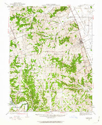
1934 Map of Elsberry
USGS Topo · Published 1934About this map
The Chicago Burlington and Quincy railroad corridor dictates the economic rhythm of eastern Lincoln County, anchoring the town of Elsberry against the flatlands west of the Mississippi. This mid-1930s survey reveals a landscape transition from the rugged terrain of the Hurricane and Calumet ridges down to the alluvial plains. Rural life is densely documented through a network of small school districts, including the Britton Sch (Negro) and Sand Ridge Sch, alongside scattered spiritual centers like Siloam Chapel and Harmony Grove Ch. The presence of the U S Government Erosion Farm and the U S Government Experiment Farm suggests a period of intensive focus on soil conservation and agricultural science during the New Deal era. Further west, the settlement at Auburn and the winding course of the Cuivre River define the local geography, punctuated by family landmarks such as Reid Cem.
Find a feature on this map
44 named features on this map. Tap any name to fly to it.
Don’t see what you’re looking for? This feature index may not catch every label — zoom into the map to look around manually.
Map Details
Editions of this 1934 Elsberry Map
2 editions found
Other maps of this area

1890 · Louisiana
USGS Topo · 1:125,000

1890 · Hermann
USGS Topo · 1:125,000

1903 · O'Fallon
USGS Topo · 1:125,000

1930 · Pearl
USGS Topo · 1:62,500

1930 · Nebo
USGS Topo · 1:62,500

1930 · Hardin
USGS Topo · 1:62,500

1931 · Brussels
USGS Topo · 1:62,500

1934 · Nebo
USGS Topo · 1:48,000

1934 · Hardin
USGS Topo · 1:62,500

1937 · Silex
USGS Topo · 1:62,500