
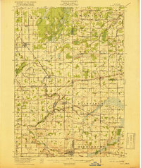
1918 Map of Elsie
USGS Topo · Published 1918About this map
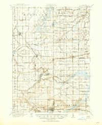
The Maple River meanders through this agricultural landscape, where the Michigan Meridian serves as a critical surveying boundary between Gratiot, Clinton, Saginaw, and Shiawassee counties. The village of Elsie sits near the river's bend, while the unusual settlement of Duplain (Rochester Colony) reflects a unique chapter of early Michigan colonization. The region's development is closely tied to its transportation network, featuring the Ann Arbor RR passing through Bannister and the Grand Trunk RR serving Ashley and Ovid. Numerous country schools, such as Elba Center School and Stafford School, are spaced across the township grids, marking the community centers of a rural economy defined by elaborate drainage systems like the Wait Drain and Sturgis Drain. This 1918 view documents the intricate network of family-named schools and small rail junctions before the consolidation of rural districts.
Find a feature on this map
101 named features on this map. Tap any name to fly to it.
Don’t see what you’re looking for? This feature index may not catch every label — zoom into the map to look around manually.
Map Details
Editions of this 1918 Elsie Map
3 editions found
Other maps of this area

1917 · Chesaning
USGS Topo · 1:62,500

1917 · St. Charles
USGS Topo · 1:62,500

1918 · Perrinton
USGS Topo · 1:62,500

1926 · Corunna
USGS Topo · 1:62,500

1927 · De Witt
USGS Topo · 1:62,500

1928 · Laingsburg
USGS Topo · 1:62,500

1929 · Corunna
USGS Topo · 1:62,500

1934 · Merrill
USGS Topo · 1:62,500

1935 · Alma
USGS Topo · 1:62,500

1937 · Merrill
USGS Topo · 1:62,500
Featured Places
- Ovid, Ovid Township
- Duplain, Duplain Township
- Chapin, Chapin Township
- Elsie, Duplain Township
- Ashley, Elba Township