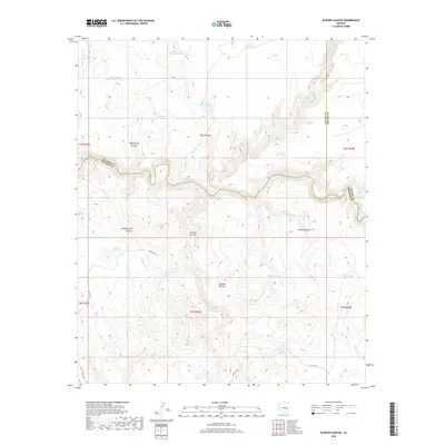
2018 Map of Elwood Canyon
USGS Topo · Published 2018About this map
The Black River winds through this high-elevation landscape, forming a natural boundary where Navajo, Graham, and Apache counties meet. This terrain is defined by its deep drainages and cattle-ranching infrastructure, featuring an extensive network of watering holes such as Rocky Basin Tank Number One, Bloody Basin Tank, and Mudhole Tank. The southern portion of the map is dominated by the massive Natanes Plateau, which rises above a series of dramatic cuts including Sawmill Canyon and Bloody Basin Canyon. These deep corridors, along with Mud Spring Canyon, illustrate the erosive power of seasonal flows feeding into the river system. Remote ranch roads like Co RD 1516 and Co RD 1553 provide the only access through this dissected country, connecting isolated points across the rugged timber and brushland of east-central Arizona.
Find a feature on this map
33 named features on this map. Tap any name to fly to it.
Don’t see what you’re looking for? This feature index may not catch every label — zoom into the map to look around manually.
Map Details
Editions of this 2018 Elwood Canyon Map
This is the sole edition of this map. No revisions or reprints were ever made.
Other maps of this area

1954 · Clifton
USGS Topo · 1:250,000
1954 · Mesa
USGS Topo · 1:250,000
1957 · Mesa
USGS Topo · 1:250,000

1957 · Clifton
USGS Topo · 1:250,000

1958 · Clifton
USGS Topo · 1:250,000
1958 · Mesa
USGS Topo · 1:250,000
1960 · Mesa
USGS Topo · 1:250,000
1962 · Clifton
USGS Topo · 1:250,000
1964 · Mesa
USGS Topo · 1:250,000
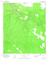
1966 · Georges Butte
USGS Topo · 1:24,000