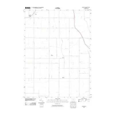
2010 Map of Elwood
USGS Topo · Published 2010About this map
Elwood and Bliedorn anchor this rural landscape in western Clinton County, where the agricultural grid is defined by a dense network of numbered avenues and streets. The settlement at Elwood serves as a local hub, featuring the Elwood Post Office and Elwood Cemetery at its northern edge. The geography is etched by several prominent waterways, most notably Deep Creek which traverses the center of the sheet, along with Silver Creek, Union Creek, and Elwood Creek. For those tracing local family histories, the map identifies key burial sites including the Saint Columbkille Cemetery and Pine Hill Cemetery, both situated amidst the farmland between the primary settlements. The survey reflects the enduring section-line road system of the Iowa prairie, showing how the drainage patterns of small creeks continue to influence the layout of rural homesteads and transport corridors.
Find a feature on this map
32 named features on this map. Tap any name to fly to it.
Don’t see what you’re looking for? This feature index may not catch every label — zoom into the map to look around manually.
Map Details
Editions of this 2010 Elwood Map
This is the sole edition of this map. No revisions or reprints were ever made.
Other maps of this area

1891 · DeWitt
USGS Topo · 1:62,500

1891 · Maquoketa
USGS Topo · 1:62,500

1891 · Baldwin
USGS Topo · 1:62,500

1892 · Wheatland
USGS Topo · 1:62,500

1894 · Wheatland
USGS Topo · 1:62,500

1901 · Peosta
USGS Topo · 1:125,000

1901 · Rock Island
USGS Topo · 1:125,000

1910 · Rock Island
USGS Topo · 1:125,000
1953 · De Witt
USGS Topo · 1:24,000
1953 · Grand Mound
USGS Topo · 1:24,000