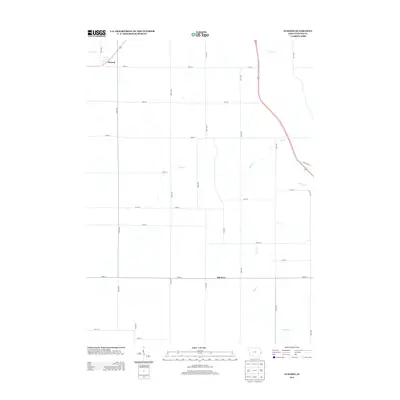
2013 Map of Elwood
USGS Topo · Published 2013About this map
Elwood and Bliedorn anchor this eastern Iowa landscape, illustrating the enduring grid of Clinton County farm roads and drainage patterns in the early 2010s. The terrain is defined by a dendritic network of waterways, including Deep Cr, Silver Cr, and Negro Cr, which carve subtle valleys through the agricultural uplands. The road network follows a strict section-line hierarchy, with arterial routes like 200th Ave and 190th St connecting isolated farmsteads to the primary settlements.
Find a feature on this map
32 named features on this map. Tap any name to fly to it.
Don’t see what you’re looking for? This feature index may not catch every label — zoom into the map to look around manually.
Map Details
Editions of this 2013 Elwood Map
This is the sole edition of this map. No revisions or reprints were ever made.
Other maps of this area

1891 · DeWitt
USGS Topo · 1:62,500

1891 · Maquoketa
USGS Topo · 1:62,500

1891 · Baldwin
USGS Topo · 1:62,500

1892 · Wheatland
USGS Topo · 1:62,500

1894 · Wheatland
USGS Topo · 1:62,500

1901 · Peosta
USGS Topo · 1:125,000

1901 · Rock Island
USGS Topo · 1:125,000

1910 · Rock Island
USGS Topo · 1:125,000
1953 · De Witt
USGS Topo · 1:24,000
1953 · Grand Mound
USGS Topo · 1:24,000