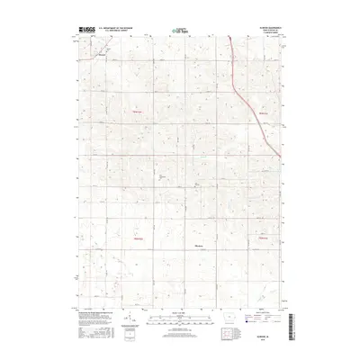
2015 Map of Elwood
USGS Topo · Published 2015About this map
Elwood and the smaller settlement of Bliedorn anchor this agricultural landscape in western Clinton County. The terrain is defined by a dendritic network of drainages, including Elwood Cr to the northwest and Deep Cr cutting through the center. A grid of county roads and avenues provides access to scattered farmsteads and several community burial sites, such as Saint Columbkille Cem and Pine Hill Cem. The presence of these cemeteries alongside established townships like t83n r2e suggests long-standing family lineages in this rural Iowa corridor. The mapping also details the winding courses of Negro Cr and Silver Cr as they move through the undulating plains, highlighting the essential relationship between the local hydrology and the structured township-and-range survey system.
Find a feature on this map
37 named features on this map. Tap any name to fly to it.
Don’t see what you’re looking for? This feature index may not catch every label — zoom into the map to look around manually.
Map Details
Editions of this 2015 Elwood Map
This is the sole edition of this map. No revisions or reprints were ever made.
Other maps of this area

1891 · DeWitt
USGS Topo · 1:62,500

1891 · Maquoketa
USGS Topo · 1:62,500

1891 · Baldwin
USGS Topo · 1:62,500

1892 · Wheatland
USGS Topo · 1:62,500

1894 · Wheatland
USGS Topo · 1:62,500

1901 · Peosta
USGS Topo · 1:125,000

1901 · Rock Island
USGS Topo · 1:125,000

1910 · Rock Island
USGS Topo · 1:125,000
1953 · De Witt
USGS Topo · 1:24,000
1953 · Grand Mound
USGS Topo · 1:24,000