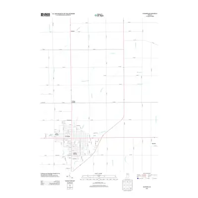
2013 Map of Elwood
USGS Topo · Published 2013About this map
Elwood and its immediate surroundings are defined by a meticulous grid of rural roads and an intricate drainage system in this Madison County survey. The urban core shows a dense street network concentrated near West Elwood and South Elwood, while the periphery is dotted with smaller communities such as Leisure to the north and Dundee to the east. The landscape's heavy reliance on water management is evident through numerous named waterways like Hoppenrath Ditch, Swanfelt Ditch, and McClure Ditch which crisscross the agricultural plains. Natural drainage is primarily provided by Big Duck Cr and Little Duck Cr, which meander through the southern and central portions of the quadrangle. This layout reveals the area's development as a coordinated intersection of industrial town-planning and large-scale agricultural infrastructure.
Find a feature on this map
107 named features on this map. Tap any name to fly to it.
Don’t see what you’re looking for? This feature index may not catch every label — zoom into the map to look around manually.
Map Details
Editions of this 2013 Elwood Map
This is the sole edition of this map. No revisions or reprints were ever made.
Other maps of this area

1953 · Muncie
USGS Topo · 1:250,000

1956 · Muncie
USGS Topo · 1:250,000

1960 · Elwood
USGS Topo · 1:24,000

1960 · Point Isabel
USGS Topo · 1:24,000

1960 · Alexandria
USGS Topo · 1:24,000

1960 · Fairmount
USGS Topo · 1:24,000

1960 · Windfall
USGS Topo · 1:24,000

1960 · Greentown
USGS Topo · 1:24,000

1960 · Anderson North
USGS Topo · 1:24,000
1961 · Omega
USGS Topo · 1:24,000