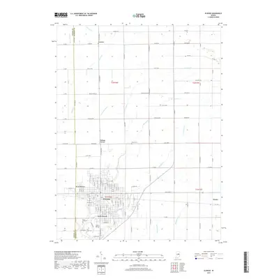
2019 Map of Elwood
USGS Topo · Published 2019About this map
Elwood serves as the central hub for this portion of Tipton and Madison Counties, where a dense street grid meets the agricultural landscape of central Indiana. The city is flanked by residential extensions like West Elwood and South Elwood, with historical sites such as Elwood Cem and Saint Joseph Cem located near the town center. The surrounding rural townships are defined by a meticulous grid of county roads and a complex network of drainage infrastructure, including Big Duck Cr, Little Duck Cr, and McClure Ditch. Smaller outlying communities such as Leisure to the north and Dundee to the east illustrate the persistence of rural crossroads settlements. Significant local sites like Sunset Memorial Park and Waymire Cem provide key points of interest for genealogists and local historians tracking family roots in the region.
Find a feature on this map
58 named features on this map. Tap any name to fly to it.
Don’t see what you’re looking for? This feature index may not catch every label — zoom into the map to look around manually.
Map Details
Editions of this 2019 Elwood Map
This is the sole edition of this map. No revisions or reprints were ever made.
Other maps of this area

1953 · Muncie
USGS Topo · 1:250,000

1956 · Muncie
USGS Topo · 1:250,000

1960 · Elwood
USGS Topo · 1:24,000

1960 · Point Isabel
USGS Topo · 1:24,000

1960 · Alexandria
USGS Topo · 1:24,000

1960 · Fairmount
USGS Topo · 1:24,000

1960 · Windfall
USGS Topo · 1:24,000

1960 · Greentown
USGS Topo · 1:24,000

1960 · Anderson North
USGS Topo · 1:24,000
1961 · Omega
USGS Topo · 1:24,000