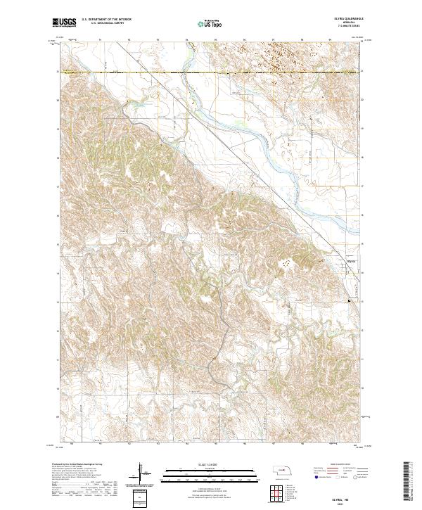
2021 Map of Elyria
USGS Topo · Published 2021About this map
Elyria serves as the primary settlement in this portion of the North Loup River valley, situated along the Taylor-Ord Canal. The landscape is defined by an extensive network of irrigation infrastructure and water management systems, including the Burwell-Sumter Canal and the Larsen-Schwartzlander Reservoir. These features highlight the region's agricultural reliance on the North Loup River, which transitions into a complex series of drainage basins such as Turtle Cr and its northern and southern branches. Outside the main townsite, the Elyria Cem provides a focal point for genealogical research, while landmarks like Fort Hartsuff Rd and Happy Jack Loop reflect the historical road patterns of Valley and Garfield Counties. The terrain reveals a distinct transition from the river lowlands to the more dissected upland breaks characterized by numerous named creeks like Bean Cr.
Find a feature on this map
36 named features on this map. Tap any name to fly to it.
Don’t see what you’re looking for? This feature index may not catch every label — zoom into the map to look around manually.
Map Details
Editions of this 2021 Elyria Map
This is the sole edition of this map. No revisions or reprints were ever made.
Other maps of this area

1952 · Burwell
USGS Topo · 1:24,000

1952 · Elyria
USGS Topo · 1:24,000

1952 · Burwell SE
USGS Topo · 1:24,000

1952 · Comstock
USGS Topo · 1:24,000

1952 · Comstock NW
USGS Topo · 1:24,000

1952 · Comstock SE
USGS Topo · 1:24,000

1954 · Ord
USGS Topo · 1:24,000

1954 · Gables SW
USGS Topo · 1:24,000

1954 · Ord NW
USGS Topo · 1:24,000

1955 · Broken Bow
USGS Topo · 1:250,000