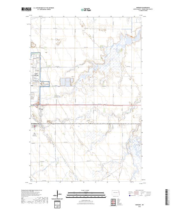
2024 Map of Emerado
USGS Topo · Published 2024About this map
Grand Forks AFB dominates the western portion of this Red River Valley landscape, characterized by the organized street grids of residential areas like Dogwood Dr and Nevada Dr. Just to the south, the settlement of Emerado serves as a local hub near the Sunset Prairie Cem - Emerado Cem, illustrating the proximity between the modern military installation and the area's established civilian roots. The eastern sections of the map are defined by conservation lands, notably the Kellys Slough National Wildlife Refuge and the Grand Forks County Waterfowl Production Area. These protected spaces preserve the complex hydrology of Kelly Slough and the winding channels of Salt Water Coulee, which cut through the agricultural sections and section lines of the prairie. The presence of the Pool 5 Trl suggests active management of these wetland habitats within a highly structured rural grid.
Find a feature on this map
30 named features on this map. Tap any name to fly to it.
Don’t see what you’re looking for? This feature index may not catch every label — zoom into the map to look around manually.
Map Details
Editions of this 2024 Emerado Map
This is the sole edition of this map. No revisions or reprints were ever made.
Other maps of this area

1926 · Ardoch
USGS Topo · 1:62,500

1934 · Emerado
USGS Topo · 1:48,000

1934 · Grand Forks
USGS Topo · 1:62,500

1936 · Emerado
USGS Topo · 1:62,500

1938 · Grand Forks
USGS Topo · 1:62,500

1952 · Grand Forks
USGS Topo · 1:250,000

1952 · Thief River Falls
USGS Topo · 1:250,000

1956 · Thief River Falls
USGS Topo · 1:250,000

1956 · Grand Forks
USGS Topo · 1:250,000

1957 · Thief River Falls
USGS Topo · 1:250,000