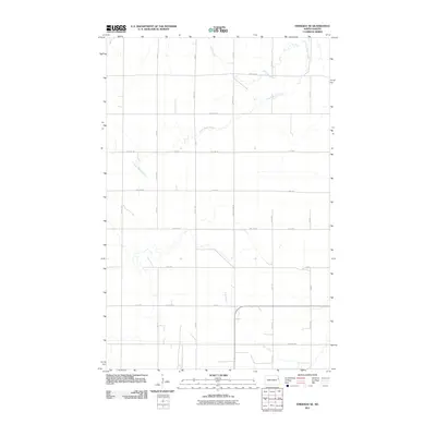
2011 Map of Emerado SE
USGS Topo · Published 2011About this map
Salt Coulee, Fresh Water Coulee, and Elm Coulee define the drainage patterns of this rural agricultural landscape in Grand Forks County. The terrain is organized by a precise grid of sections and section-line roads, such as 24th St and County Hwy 13, which facilitate the region's farming economy. The map demonstrates the systematic layout of the Red River Valley, where the natural wandering of coulees contrasts sharply with the rigid human imposition of 13th Ave NE and other surveyed thoroughfares. This alignment of natural watercourses and man-made infrastructure illustrates the late 20th and early 21st-century land-use patterns common across the North Dakota plains.
Find a feature on this map
27 named features on this map. Tap any name to fly to it.
Don’t see what you’re looking for? This feature index may not catch every label — zoom into the map to look around manually.
Map Details
Editions of this 2011 Emerado SE Map
This is the sole edition of this map. No revisions or reprints were ever made.
Other maps of this area

1934 · Emerado
USGS Topo · 1:48,000

1934 · Grand Forks
USGS Topo · 1:62,500

1936 · Emerado
USGS Topo · 1:62,500

1938 · Grand Forks
USGS Topo · 1:62,500

1952 · Grand Forks
USGS Topo · 1:250,000

1956 · Grand Forks
USGS Topo · 1:250,000
1963 · Kelly
USGS Topo · 1:24,000

1963 · Emerado SE
USGS Topo · 1:24,000
1963 · Emerado
USGS Topo · 1:24,000

1963 · Emerado SW
USGS Topo · 1:24,000