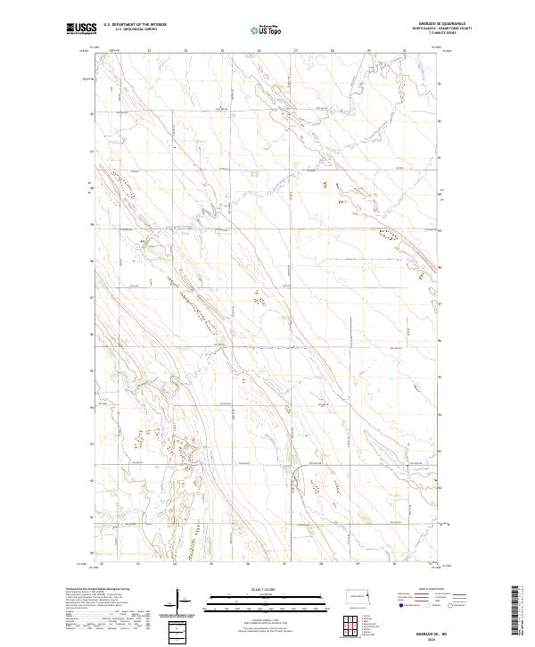
2024 Map of Emerado SE
USGS Topo · Published 2024About this map
The agrarian landscape of Grand Forks County is defined here by the natural drainage of the Red River Valley, where the winding paths of Salt Coulee and Fresh Water Coulee cut through the geometric precision of the Public Land Survey System. In this corner of North Dakota, the section-line road network is highly developed, with corridors like Co Rd 6 and Co Rd 3 providing the primary framework for local travel. The terrain is characterized by subtle elevation changes along Elm Coulee in the southern portion of the quadrangle. This map reflects the enduring rural character of the region, where transportation routes such as 13th Ave NE and 24th St NE trace the boundaries of vast agricultural tracts typical of the northern Great Plains.
Find a feature on this map
27 named features on this map. Tap any name to fly to it.
Don’t see what you’re looking for? This feature index may not catch every label — zoom into the map to look around manually.
Map Details
Editions of this 2024 Emerado SE Map
This is the sole edition of this map. No revisions or reprints were ever made.
Other maps of this area

1934 · Emerado
USGS Topo · 1:48,000

1934 · Grand Forks
USGS Topo · 1:62,500

1936 · Emerado
USGS Topo · 1:62,500

1938 · Grand Forks
USGS Topo · 1:62,500

1952 · Grand Forks
USGS Topo · 1:250,000

1956 · Grand Forks
USGS Topo · 1:250,000
1963 · Kelly
USGS Topo · 1:24,000

1963 · Emerado SE
USGS Topo · 1:24,000
1963 · Emerado
USGS Topo · 1:24,000

1963 · Emerado SW
USGS Topo · 1:24,000