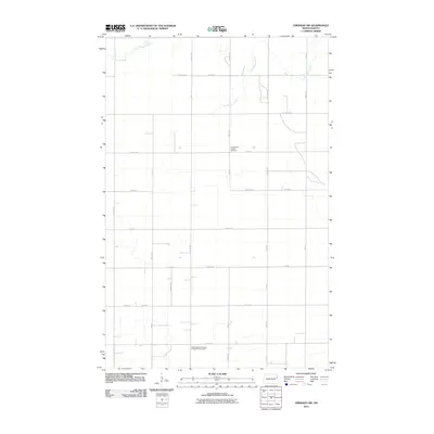
2011 Map of Emerado SW
USGS Topo · Published 2011About this map
The agrarian landscape of Grand Forks County is defined by a strictly surveyed grid of section lines and isolated cultural landmarks. The Washington Norwegian Evangelical Lutheran church stands in the southern portion of the quadrangle, reflecting the heritage of the settlers who established the local townships. Further north, the Evangelical United Brethren church serves as another community anchor amidst the wide-open fields. The terrain is subtly marked by drainage patterns like Salt Water Coulee, which winds through the northeastern sections, and Hazen Brook in the northwest. This 2011 survey captures the area’s enduring rural character, where local movement is dictated by numbered thoroughfares such as 29th St NE and 13th Ave NE, maintaining a settlement pattern little changed by modern development.
Find a feature on this map
30 named features on this map. Tap any name to fly to it.
Don’t see what you’re looking for? This feature index may not catch every label — zoom into the map to look around manually.
Map Details
Editions of this 2011 Emerado SW Map
This is the sole edition of this map. No revisions or reprints were ever made.
Other maps of this area

1934 · Emerado
USGS Topo · 1:48,000

1936 · Emerado
USGS Topo · 1:62,500

1936 · Larimore
USGS Topo · 1:62,500

1952 · Grand Forks
USGS Topo · 1:250,000

1956 · Grand Forks
USGS Topo · 1:250,000

1963 · Larimore East
USGS Topo · 1:24,000

1963 · Kempton
USGS Topo · 1:24,000

1963 · Emerado SE
USGS Topo · 1:24,000
1963 · Emerado
USGS Topo · 1:24,000

1963 · Emerado SW
USGS Topo · 1:24,000