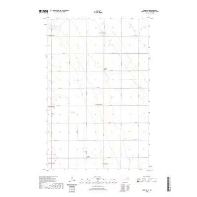
2020 Map of Emerado SW
USGS Topo · Published 2020About this map
Gran Church Cem and Washington Lutheran Church Cem anchor the rural landscape of Grand Forks County, marking the spiritual and communal centers of this North Dakota prairie. The map reveals a strictly organized section-line grid of roads, such as 31st St NE and 11th Ave NE, which navigate around subtle drainage features like Hazen Brook and the Salt Water Coulee. This layout reflects the enduring influence of the Public Land Survey System on the Northern Plains, where homesteading patterns dictated the placement of institutions like the Evangelical United Brethren church. The sparse distribution of buildings suggests a region primarily dedicated to large-scale agriculture, where the occasional church or cemetery serves as a landmark for the widely dispersed farming population.
Find a feature on this map
31 named features on this map. Tap any name to fly to it.
Don’t see what you’re looking for? This feature index may not catch every label — zoom into the map to look around manually.
Map Details
Editions of this 2020 Emerado SW Map
This is the sole edition of this map. No revisions or reprints were ever made.
Other maps of this area

1934 · Emerado
USGS Topo · 1:48,000

1936 · Emerado
USGS Topo · 1:62,500

1936 · Larimore
USGS Topo · 1:62,500

1952 · Grand Forks
USGS Topo · 1:250,000

1956 · Grand Forks
USGS Topo · 1:250,000

1963 · Larimore East
USGS Topo · 1:24,000

1963 · Kempton
USGS Topo · 1:24,000

1963 · Emerado SE
USGS Topo · 1:24,000
1963 · Emerado
USGS Topo · 1:24,000

1963 · Emerado SW
USGS Topo · 1:24,000