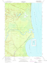
1951 Map of Emerson
USGS Topo · Published 1977About this map
Whitefish Bay meets the mouth of the Tahquamenon River on this Upper Peninsula coastline, where the settlement of Emerson and the nearby village of Paradise define the local landscape. The map illustrates a mid-century community tied to the land and water, featuring the Whitefish Sch, Baptist Ch, and Our Lady of Victory Ch. Inland, the terrain is dominated by the Tahquamenon Falls State Park and the Lake Superior State Forest, where numerous recreational and hunting outposts like the Hiawatha Hunt Club and Soo Machine Club are scattered among wetlands and small lakes like Preacher Lake. The river's winding path toward Tahquamenon Bay includes Snug Harbor and is paralleled by Whitefish Road, reflecting the area's transition from a logging and fishing hub into a center for conservation and recreation within the Hiawatha National Forest.
Find a feature on this map
39 named features on this map. Tap any name to fly to it.
Don’t see what you’re looking for? This feature index may not catch every label — zoom into the map to look around manually.
Map Details
Editions of this 1951 Emerson Map
2 editions found
Other maps of this area

1941 · Strongs
USGS Topo · 1:63,360

1951 · Shelldrake
USGS Topo · 1:24,000

1951 · McNearney Lake
USGS Topo · 1:24,000

1951 · Sheephead Lake
USGS Topo · 1:24,000

1951 · Emerson
USGS Topo · 1:24,000

1951 · Piatt Lake
USGS Topo · 1:24,000

1951 · Big Beaver Creek
USGS Topo · 1:24,000

1951 · Timberlost
USGS Topo · 1:24,000

1951 · Strongs
USGS Topo · 1:62,500

1951 · Eckerman
USGS Topo · 1:62,500