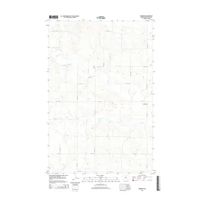
2014 Map of Emerson
USGS Topo · Published 2014About this map
Emerson serves as the central focal point of this rural North Dakota landscape, situated along the eastern edge of the quadrangle. The terrain is defined by the winding course of the Knife River, which snakes across the northern and eastern sections of the sheet, joined by smaller tributaries including Crooked Cr and Stray Cr. The map reveals a highly structured rectilinear grid of local section roads, including 104th Ave SW and 16th St SW, which partition the prairie into a regular patchwork of land use typical of the Great Plains. This 2014 survey illustrates a modern view of the region's hydrography and topography, showing how the drainage patterns of the Knife River basin continue to shape the development and road networks of this part of Dunn County.
Find a feature on this map
18 named features on this map. Tap any name to fly to it.
Don’t see what you’re looking for? This feature index may not catch every label — zoom into the map to look around manually.
Map Details
Editions of this 2014 Emerson Map
This is the sole edition of this map. No revisions or reprints were ever made.
Other maps of this area

1953 · Watford City
USGS Topo · 1:250,000

1957 · Watford City
USGS Topo · 1:250,000

1967 · Watford City
USGS Topo · 1:250,000
1973 · Manning SE
USGS Topo · 1:24,000
1973 · Ziner Butte
USGS Topo · 1:24,000
1973 · Hirschville SW
USGS Topo · 1:24,000
1973 · Hirschville
USGS Topo · 1:24,000
1973 · Manning
USGS Topo · 1:24,000
1973 · Dunn Center
USGS Topo · 1:24,000
1973 · Emerson
USGS Topo · 1:24,000