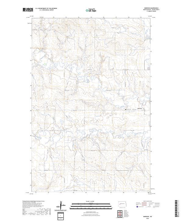
2024 Map of Emerson
USGS Topo · Published 2024About this map
The Knife River carves a winding path across this portion of Dunn County, defining the drainage patterns and topography of the Missouri Plateau. This landscape is characterized by its rural grid, where arterial section lines like 101st Ave SW and 16th St SW intersect to form the skeletal structure of the ranching and farming community. The small settlement of Emerson serves as a local anchor, centered near the Emerson Cem. Hydrological features including Crooked Creek and Stray Creek branch through the rolling plains, creating natural breaks in the otherwise geometric township and range system. This map captures a quintessential North Dakota prairie landscape where the placement of cemeteries and local road names remains a vital link to family history and the agricultural heritage of the region.
Find a feature on this map
23 named features on this map. Tap any name to fly to it.
Don’t see what you’re looking for? This feature index may not catch every label — zoom into the map to look around manually.
Map Details
Editions of this 2024 Emerson Map
This is the sole edition of this map. No revisions or reprints were ever made.
Other maps of this area

1953 · Watford City
USGS Topo · 1:250,000

1957 · Watford City
USGS Topo · 1:250,000

1967 · Watford City
USGS Topo · 1:250,000

1973 · Manning SE
USGS Topo · 1:24,000

1973 · Ziner Butte
USGS Topo · 1:24,000
1973 · Hirschville SW
USGS Topo · 1:24,000
1973 · Hirschville
USGS Topo · 1:24,000

1973 · Manning
USGS Topo · 1:24,000

1973 · Dunn Center
USGS Topo · 1:24,000

1973 · Emerson
USGS Topo · 1:24,000