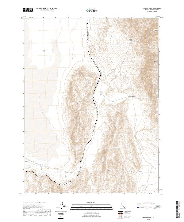
2021 Map of Emerson Pass
USGS Topo · Published 2021About this map
Smoke Creek Desert defines the western edge of this Nevada landscape, transitioning into the elevated terrain of the Fox Range and the Terraced Hills. This 2021 survey by the U.S. Geological Survey documents the sparse settlement patterns of Washoe County, centered on the location of Sano. The geography is characterized by dramatic elevation changes through Mullens Canyon and the namesake Emerson Pass, a critical topographical corridor in this arid region. For researchers of the Great Basin, the map identifies essential water sources such as Soda Springs, providing insight into the survival and transit requirements of this high-desert environment. The clear demarcation of township lines, including t29n r20e and t28n r21e, provides a precise framework for locating land parcels within this vast, unpopulated stretch of the Nevada interior.
Find a feature on this map
11 named features on this map. Tap any name to fly to it.
Don’t see what you’re looking for? This feature index may not catch every label — zoom into the map to look around manually.
Map Details
Editions of this 2021 Emerson Pass Map
This is the sole edition of this map. No revisions or reprints were ever made.
Other maps of this area

1886 · Granite Range
USGS Topo · 1:250,000

1894 · Granite Range
USGS Topo · 1:250,000

1955 · Lovelock
USGS Topo · 1:250,000

1959 · Lovelock
USGS Topo · 1:250,000

1964 · The Needle Rocks
USGS Topo · 1:24,000
1964 · Astor Pass
USGS Topo · 1:24,000

1964 · Pyramid NE
USGS Topo · 1:24,000

1965 · Fox Range
USGS Topo · 1:62,500
1980 · Sand Pass
USGS Topo · 1:24,000
1981 · Sheepshead Spring
USGS Topo · 1:24,000