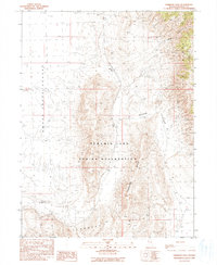
1990 Map of Emerson Pass
USGS Topo · Published 1990About this map
The Pyramid Lake Indian Reservation encompasses much of this Basin and Range landscape, where the flat expanse of the Smoke Creek Desert meets the rising elevations of the Fox Range and the Terraced Hills. This high-desert environment shows limited human settlement, centered primarily on the location of Sano and the historical activity at Packard Mine in the northeastern corner. Transportation through the rugged terrain is defined by Emerson Pass and various 4wd tracks that follow the natural contours of the land. Water remains a critical element for the region, noted by the presence of Soda Springs at the base of the hills. The map provides a clear look at the township and range boundaries, including T 29 N T 28 N, which were vital for land management in this part of Washoe County.
Find a feature on this map
11 named features on this map. Tap any name to fly to it.
Don’t see what you’re looking for? This feature index may not catch every label — zoom into the map to look around manually.
Map Details
Editions of this 1990 Emerson Pass Map
This is the sole edition of this map. No revisions or reprints were ever made.
Other maps of this area

1886 · Granite Range
USGS Topo · 1:250,000

1894 · Granite Range
USGS Topo · 1:250,000

1955 · Lovelock
USGS Topo · 1:250,000

1959 · Lovelock
USGS Topo · 1:250,000

1964 · The Needle Rocks
USGS Topo · 1:24,000
1964 · Astor Pass
USGS Topo · 1:24,000

1964 · Pyramid NE
USGS Topo · 1:24,000

1965 · Fox Range
USGS Topo · 1:62,500
1980 · Sand Pass
USGS Topo · 1:24,000
1981 · Sheepshead Spring
USGS Topo · 1:24,000