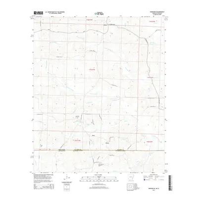
2014 Map of Emerson SE
USGS Topo · Published 2014About this map
Atlanta and Owens anchor the northern and central portions of this landscape, which straddles the state line between Columbia County, Arkansas, and Claiborne Parish, Louisiana. The terrain is defined by a dense network of waterways, including the winding Little Cornie Bayou, Pigeon Roost Cr, and Sassafras Cr, which converge near the settlement of Ware. The map reveals a mix of timber-driven hydrology and active industrial extraction, most notably the East Haynesville Oil and Gas Field in the southern portion of the sheet.
Find a feature on this map
49 named features on this map. Tap any name to fly to it.
Don’t see what you’re looking for? This feature index may not catch every label — zoom into the map to look around manually.
Map Details
Editions of this 2014 Emerson SE Map
This is the sole edition of this map. No revisions or reprints were ever made.
Other maps of this area

1951 · Summerfield
USGS Topo · 1:62,500

1952 · Homer
USGS Topo · 1:62,500

1953 · El Dorado
USGS Topo · 1:250,000

1955 · Shreveport
USGS Topo · 1:250,000

1956 · Shreveport
USGS Topo · 1:250,000

1957 · El Dorado
USGS Topo · 1:250,000

1958 · El Dorado
USGS Topo · 1:250,000

1960 · El Dorado
USGS Topo · 1:250,000

1966 · Calhoun
USGS Topo · 1:24,000

1966 · Spotville
USGS Topo · 1:24,000