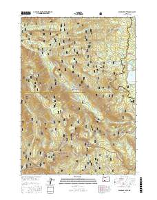
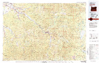
2017 Map of Emigrant Butte
USGS Topo · Published 2017About this map
The Calapooya Mountains and the high peaks of the Cascade Range dominate this 2017 survey, where three major wilderness jurisdictions converge: the Deschutes National Forest, Willamette National Forest, and Umpqua National Forest. This remote alpine landscape is defined by its glacial hydrology and volcanic geology, featuring prominent landmarks like Diamond Peak and the namesake Emigrant Butte. The map details the headwaters of the Middle Fork Willamette River and numerous high-altitude water bodies, including Rockpile Lake, Summit Lake, and Beaver Marsh. The transport network here is primarily recreational and administrative, marked by the Pacific Crest National Scenic Trail and various snowmobile routes such as the Happy Prairie Snowmobile trail. Historical transit is evidenced by Emigrant Pass and the rugged forest roads that wind through Paddys Valley and past Hills Peak.
Find a feature on this map
63 named features on this map. Tap any name to fly to it.
Don’t see what you’re looking for? This feature index may not catch every label — zoom into the map to look around manually.
Map Details
Editions of this 2017 Emigrant Butte Map
This is the sole edition of this map. No revisions or reprints were ever made.
Other maps of this area
1917 · Diamond Lake
USGS Topo · 1:125,000
1925 · Waldo Lake
USGS Topo · 1:125,000
1956 · Toketee Falls
USGS Topo · 1:62,500
1956 · Waldo Lake
USGS Topo · 1:62,500
1956 · Summit Lake
USGS Topo · 1:62,500
1956 · Oakridge
USGS Topo · 1:62,500

1958 · Roseburg
USGS Topo · 1:250,000

1959 · Roseburg
USGS Topo · 1:250,000
1978 · Diamond Lake
USGS Topo · 1:100,000
1983 · Oakridge
USGS Topo · 1:100,000