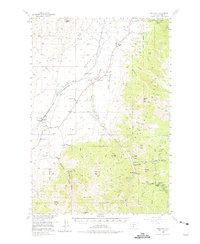
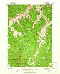
1955 Map of Emigrant
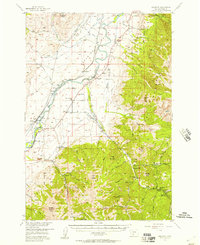
USGS Topo · Published 1975About this map
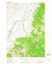
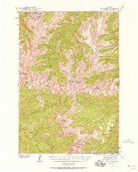
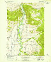
Paradise Valley serves as a lush corridor for the Yellowstone River and the Northern Pacific railroad, defining the heart of this mid-century Montana landscape. The map reveals a community deeply rooted in the valley's thermal and agricultural resources, centered on the historic Chico Hot Springs and the nearby Chico Cem. Water management is a primary focus of the era's infrastructure, evidenced by an extensive network of irrigation features like the Upland DITCH and the Mill Creek Flat Sch. Moving away from the river bottom, the terrain ascends sharply into the Gallatin National Forest, where high peaks like Emigrant Peak and Chico Peak overlook a landscape transitioning from valley floor farms to remote mountain mining and recreation sites such as the Barbara Ann Mine and Snowy Range Ranch.
Find a feature on this map
73 named features on this map. Tap any name to fly to it.
Don’t see what you’re looking for? This feature index may not catch every label — zoom into the map to look around manually.
Map Details
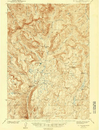
Editions of this 1955 Emigrant Map
3 editions found
Other maps of this area

1891 · Livingston
USGS Topo · 1:250,000

1893 · Livingston
USGS Topo · 1:250,000
1940 · Mt. Cowen
USGS Topo · 1:62,500
1940 · Mt Wallace
USGS Topo · 1:62,500
1943 · Mt Wallace
USGS Topo · 1:62,500
1943 · Mt Cowen
USGS Topo · 1:62,500

1947 · Bozeman
USGS Topo · 1:250,000

1948 · Bozeman
USGS Topo · 1:250,000
1951 · Bozeman Pass
USGS Topo · 1:62,500
1951 · Brisbin
USGS Topo · 1:24,000