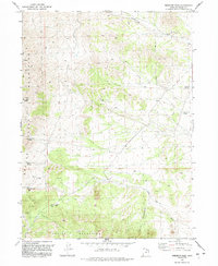
1991 Map of Emigrant Pass
USGS Topo · Published 1992About this map
Grouse Creek Mountains and the Bovine Mountains dominate this high-desert landscape in northwestern Utah, surveyed in the late twentieth century. The map centers on the high-elevation passage at Emigrant Pass, where a Radio Tower stands as a modern waypoint. The terrain is defined by its arid hydrology, marked by numerous isolated water sources such as Bovine Spring, Sheep Trail Spring, and Chokecherry Spring.
Find a feature on this map
18 named features on this map. Tap any name to fly to it.
Don’t see what you’re looking for? This feature index may not catch every label — zoom into the map to look around manually.
Map Details
Editions of this 1991 Emigrant Pass Map
This is the sole edition of this map. No revisions or reprints were ever made.
Other maps of this area

1954 · Brigham City
USGS Topo · 1:250,000

1958 · Brigham City
USGS Topo · 1:250,000

1962 · Brigham City
USGS Topo · 1:250,000

1967 · Lucin NE
USGS Topo · 1:24,000

1971 · Prohibition Spring
USGS Topo · 1:24,000

1971 · Emigrant Pass
USGS Topo · 1:24,000

1971 · Potters Creek
USGS Topo · 1:24,000
1971 · Rocky Pass Peak
USGS Topo · 1:24,000

1971 · Warm Spring Hills
USGS Topo · 1:24,000
1971 · Ingham Canyon
USGS Topo · 1:24,000