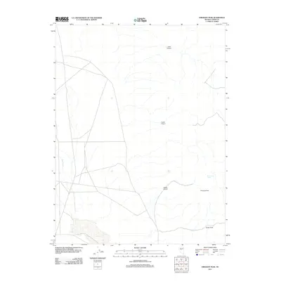
2011 Map of Emigrant Peak
USGS Topo · Published 2011About this map
Emigrant Peak stands as a prominent high point in this 2011 survey of Lander County, Nevada. The landscape is defined by a network of drainage features that cut through the high desert terrain, including Sand Canyon to the north and Acree Canyon near the center. Water sources are critical landmarks in this arid region, as evidenced by the marking of Ryan Canyon Spring and the drainage courses of Porter Creek and Smith Creek. The map documents a sparsely populated area where the natural topography and primitive road networks dictate the layout of the land. The presence of Gilbert Canyon further illustrates the deeply eroded character of the mountainsides surrounding the peak, providing a detailed record of the physical geography of this portion of Nevada in the early 21st century.
Find a feature on this map
7 named features on this map. Tap any name to fly to it.
Don’t see what you’re looking for? This feature index may not catch every label — zoom into the map to look around manually.
Map Details
Editions of this 2011 Emigrant Peak Map
This is the sole edition of this map. No revisions or reprints were ever made.
Other maps of this area

1955 · Millett
USGS Topo · 1:250,000

1959 · Millett
USGS Topo · 1:250,000

1966 · Edwards Creek Valley
USGS Topo · 1:62,500

1969 · Mount Airy
USGS Topo · 1:24,000

1969 · Gandolfo Canyon
USGS Topo · 1:24,000

1969 · Mount Airy Mesa
USGS Topo · 1:24,000

1969 · Emigrant Peak
USGS Topo · 1:24,000

1969 · Dutch Flat
USGS Topo · 1:24,000

1969 · Carroll Summit NE
USGS Topo · 1:24,000

1969 · Iron Mountain
USGS Topo · 1:24,000