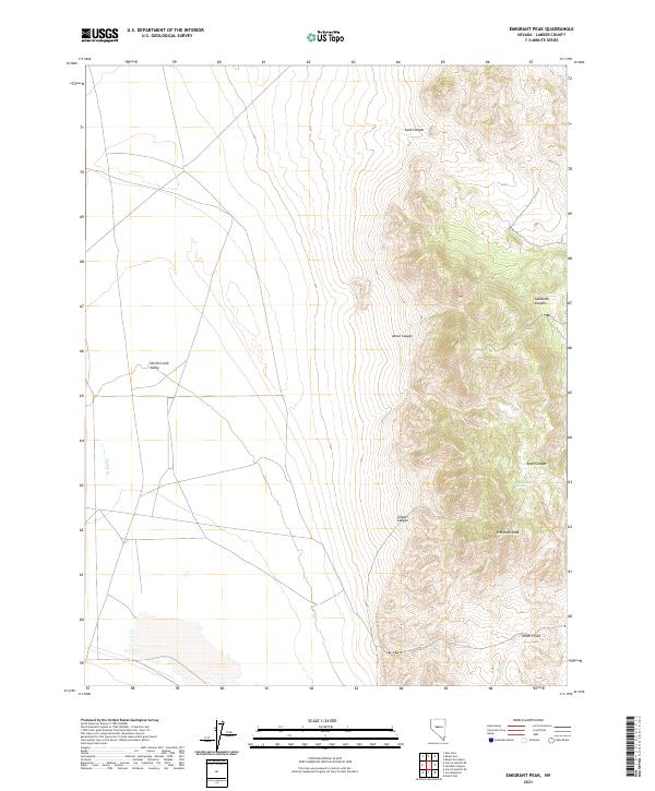
2021 Map of Emigrant Peak
USGS Topo · Published 2021About this map
Emigrant Peak dominates the high desert landscape of central Nevada, standing as a prominent landmark above the eastern transition into Smith Creek Valley. This modern topographical study reveals a terrain defined by deep erosional cuts and seasonal water sources, most notably at Ryan Canyon Spring within the winding Ryan Canyon. To the north and west, the map details several significant drainage systems, including Sand Canyon, Acree Canyon, and Gandolfo Canyon, which channel toward the valley floor. The western reaches are characterized by the more level expanse of the valley, where the ephemeral Porter Cr and Smith Creek are traced. The absence of built settlements emphasizes the remote nature of this part of Lander County, where the topography remains the primary guide for navigation and land use.
Find a feature on this map
16 named features on this map. Tap any name to fly to it.
Don’t see what you’re looking for? This feature index may not catch every label — zoom into the map to look around manually.
Map Details
Editions of this 2021 Emigrant Peak Map
This is the sole edition of this map. No revisions or reprints were ever made.
Other maps of this area

1955 · Millett
USGS Topo · 1:250,000

1959 · Millett
USGS Topo · 1:250,000

1966 · Edwards Creek Valley
USGS Topo · 1:62,500

1969 · Mount Airy
USGS Topo · 1:24,000

1969 · Gandolfo Canyon
USGS Topo · 1:24,000

1969 · Mount Airy Mesa
USGS Topo · 1:24,000

1969 · Emigrant Peak
USGS Topo · 1:24,000

1969 · Dutch Flat
USGS Topo · 1:24,000

1969 · Carroll Summit NE
USGS Topo · 1:24,000

1969 · Iron Mountain
USGS Topo · 1:24,000