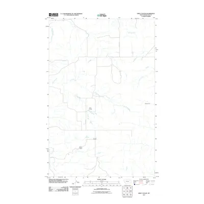
2011 Map of Emily Coulee
USGS Topo · Published 2011About this map
Emily Coulee occupies a landscape defined by an intricate network of drainage systems in McCone County. This 2011 survey reveals a sparse ranching and agricultural environment where water management is central to the land's utility, evidenced by structures such as Westgard Dam and Martin Number 1 Dam. The terrain is deeply etched by numerous waterways, including the meandering paths of Big Mud Creek, Little Mud Creek, and Crow Creek, which converge and diverge across the prairie. For those researching local history, the Prairie Elk Cemetery serves as a significant landmark of early community life, situated south of the junction of several creek branches. The transportation network is minimal, with Highland Rd providing one of the few primary arteries through the drainage basins of Prairie Elk Creek and Box Elder Creek.
Find a feature on this map
10 named features on this map. Tap any name to fly to it.
Don’t see what you’re looking for? This feature index may not catch every label — zoom into the map to look around manually.
Map Details
Editions of this 2011 Emily Coulee Map
This is the sole edition of this map. No revisions or reprints were ever made.
Other maps of this area

1915 · Oswego
USGS Topo · 1:62,500

1916 · Wolf Point
USGS Topo · 1:62,500

1954 · Glendive
USGS Topo · 1:250,000

1954 · Wolf Point
USGS Topo · 1:250,000

1957 · Glendive
USGS Topo · 1:250,000

1958 · Wolf Point
USGS Topo · 1:250,000

1958 · Glendive
USGS Topo · 1:250,000

1972 · Wolf Point
USGS Topo · 1:24,000
1972 · Flynn Creek South
USGS Topo · 1:24,000
1972 · Oswego
USGS Topo · 1:24,000