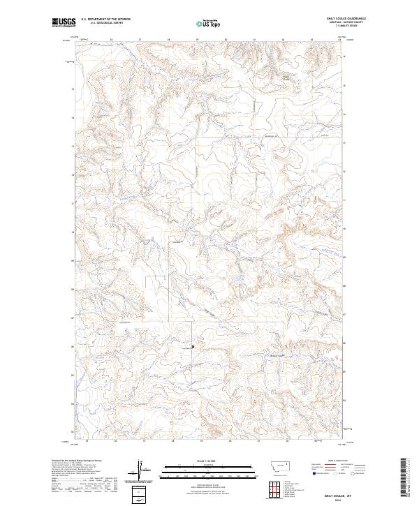
2024 Map of Emily Coulee
USGS Topo · Published 2024About this map
Prairie Elk Cem serves as a lone cultural landmark within this landscape of McCone County, Montana. The terrain is defined by an intricate network of drainage channels, including the namesake Emily Coulee and larger waterways like Big Mud Creek and Prairie Elk Creek. This contemporary survey illustrates the enduring nature of the Public Land Survey System, with township and range lines like t25n r46e providing the grid for a handful of rural transit routes such as Highland Rd and Mendenhall Rd. The presence of numerous named coulees—including Steele, O'Dell, and Browns—highlights the erosional geography that has dictated land use and road placement in this part of the northern plains for generations. Sparse human infrastructure like Field Trl and Hwy 528 indicates the cattle-ranching character of the region, where water sources like Antelope Creek remain the primary geographical anchors.
Find a feature on this map
20 named features on this map. Tap any name to fly to it.
Don’t see what you’re looking for? This feature index may not catch every label — zoom into the map to look around manually.
Map Details
Editions of this 2024 Emily Coulee Map
This is the sole edition of this map. No revisions or reprints were ever made.
Other maps of this area

1915 · Oswego
USGS Topo · 1:62,500

1916 · Wolf Point
USGS Topo · 1:62,500

1954 · Glendive
USGS Topo · 1:250,000

1954 · Wolf Point
USGS Topo · 1:250,000

1957 · Glendive
USGS Topo · 1:250,000

1958 · Wolf Point
USGS Topo · 1:250,000

1958 · Glendive
USGS Topo · 1:250,000

1972 · Wolf Point
USGS Topo · 1:24,000
1972 · Flynn Creek South
USGS Topo · 1:24,000
1972 · Oswego
USGS Topo · 1:24,000