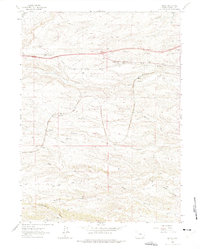
1962 Map of Emkay
USGS Topo · Published 1975About this map
Union Pacific rail operations define the high plains corridor of this 1962 survey, with small trackside settlements like Granite Canon and Corlett anchoring the transport network. The landscape is deeply incised by a series of parallel drainage systems running west to east, including Lone Tree Creek, Willow Creek, and Goose Creek. These watercourses created natural paths for early transportation and surveying, evidenced by the alignment of the Pipeline and the proximity of the Happy Jack Road to the northern edge of the quadrangle. Smaller points like Otto and Emkay represent the sparse but critical industrial and residential hubs of Laramie County during the early 1960s. Farther south, the terrain becomes even more dissected by Duck Creek and Spotwood Creek, illustrating the complex hydrology that influenced ranching and grazing patterns across this stretch of the Wyoming interior.
Find a feature on this map
20 named features on this map. Tap any name to fly to it.
Don’t see what you’re looking for? This feature index may not catch every label — zoom into the map to look around manually.
Map Details
Editions of this 1962 Emkay Map
3 editions found
Other maps of this area

1905 · Sherman
USGS Topo · 1:125,000

1907 · Livermore
USGS Topo · 1:125,000

1908 · Eaton
USGS Topo · 1:125,000

1909 · Livermore
USGS Topo · 1:125,000

1910 · Eaton
USGS Topo · 1:125,000

1911 · Cheyenne
USGS Topo · 1:125,000

1914 · Cheyenne
USGS Topo · 1:125,000

1950 · Cheyenne
USGS Topo · 1:62,500

1954 · Cheyenne
USGS Topo · 1:250,000

1954 · Greeley
USGS Topo · 1:250,000