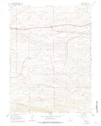
1962 Map of Emkay
USGS Topo · Published 1978About this map
Union Pacific rail lines anchor the northern half of this Wyoming landscape, connecting the small industrial and transit points of Otto, Corlett, and Emkay. This 1960s survey illustrates a region defined by its numerous drainages, where a series of eastward-flowing watercourses—Lone Tree Creek, Willow Creek, and Goose Creek—cut through the high plains toward the Cheyenne vicinity. The infrastructure of the era is marked by the presence of Happy Jack Road and the pipeline routes that follow the contours of the drainage basins. Further south, the map details the headwaters of Duck Creek and Spotwood Creek, showing a transition into more dissected terrain. These features reflect the importance of rail and water management in Laramie County's development during the mid-20th century, providing a clear view of the ranching and transportation corridors that shaped the area's growth.
Find a feature on this map
22 named features on this map. Tap any name to fly to it.
Don’t see what you’re looking for? This feature index may not catch every label — zoom into the map to look around manually.
Map Details
Editions of this 1962 Emkay Map
3 editions found
Other maps of this area

1905 · Sherman
USGS Topo · 1:125,000

1907 · Livermore
USGS Topo · 1:125,000

1908 · Eaton
USGS Topo · 1:125,000

1909 · Livermore
USGS Topo · 1:125,000

1910 · Eaton
USGS Topo · 1:125,000

1911 · Cheyenne
USGS Topo · 1:125,000

1914 · Cheyenne
USGS Topo · 1:125,000

1950 · Cheyenne
USGS Topo · 1:62,500

1954 · Cheyenne
USGS Topo · 1:250,000

1954 · Greeley
USGS Topo · 1:250,000