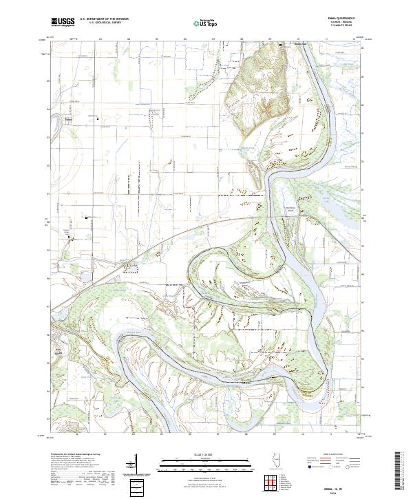
2024 Map of Emma
USGS Topo · Published 2024About this map
The Wabash River and Little Wabash River dominate this landscape, carving a complex series of meanders and cutoffs along the border of Illinois and Indiana. The river's historical shifts are evident in features like Old River, Little Chain Cutoff, and the expansive Greathouse Island. These waterways have long shaped the local economy and geography, creating a network of sloughs and ponds including Brushy Slough, Grassy Slough, and Fishpond Swamp.
Find a feature on this map
50 named features on this map. Tap any name to fly to it.
Don’t see what you’re looking for? This feature index may not catch every label — zoom into the map to look around manually.
Map Details
Editions of this 2024 Emma Map
This is the sole edition of this map. No revisions or reprints were ever made.
Other maps of this area

1903 · New Harmony
USGS Topo · 1:62,500

1903 · Patoka
USGS Topo · 1:125,000

1905 · New Haven
USGS Topo · 1:62,500

1906 · New Haven
USGS Topo · 1:62,500

1917 · Uniontown
USGS Topo · 1:62,500

1938 · New Harmony
USGS Topo · 1:62,500

1940 · Carmi
USGS Topo · 1:62,500

1943 · Carmi
USGS Topo · 1:62,500

1949 · Paducah
USGS Topo · 1:250,000

1949 · New Haven
USGS Topo · 1:62,500