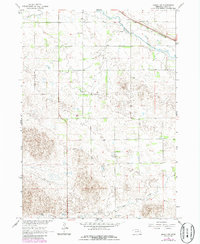
1964 Map of Emmet NW
USGS Topo · Published 1986About this map
The Elkhorn River meanders across this corner of Nebraska, anchoring a landscape shaped by water and transport in the mid-1960s. The northern territory is dominated by the Chicago and North Western railroad corridor, which parallels the river and passes a local Gravel Pit. This survey captures the rural educational infrastructure of the period, specifically documenting School No 35 in the north and School No 99 further south, providing fixed points for local genealogy and land-use studies.
Find a feature on this map
9 named features on this map. Tap any name to fly to it.
Don’t see what you’re looking for? This feature index may not catch every label — zoom into the map to look around manually.
Map Details
Editions of this 1964 Emmet NW Map
2 editions found
Other maps of this area

1954 · Atkinson SE
USGS Topo · 1:24,000

1954 · Atkinson
USGS Topo · 1:24,000

1954 · Stuart SE
USGS Topo · 1:24,000

1955 · O'Neill
USGS Topo · 1:250,000

1959 · O'Neill
USGS Topo · 1:250,000

1964 · Emmet NW
USGS Topo · 1:24,000

1964 · Emmet SE
USGS Topo · 1:24,000

1964 · Emmet SW
USGS Topo · 1:24,000

1964 · Emmet
USGS Topo · 1:24,000

1969 · O'Neill
USGS Topo · 1:250,000