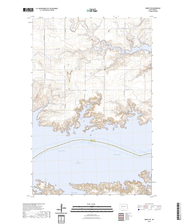
2024 Map of Emmet SW
USGS Topo · Published 2024About this map
The Missouri River defines the central geography of this landscape, where the rising waters of Lake Sakakawea have created a complex shoreline of deep inlets and peninsulas. Several prominent water bodies, including Douglas Creek Bay, Berthold Bay, and Beulah Bay, demonstrate how the inundated valley has transformed the regional terrain. The map records the interface between McLean and Mercer Counties along the river's path, showing the submerged former course of the Missouri as it winds through the reservoir.
Find a feature on this map
18 named features on this map. Tap any name to fly to it.
Don’t see what you’re looking for? This feature index may not catch every label — zoom into the map to look around manually.
Map Details
Editions of this 2024 Emmet SW Map
This is the sole edition of this map. No revisions or reprints were ever made.
Other maps of this area

1954 · McClusky
USGS Topo · 1:250,000

1956 · Emmet NE
USGS Topo · 1:24,000

1956 · Blackwater Lake
USGS Topo · 1:24,000

1956 · Emmet
USGS Topo · 1:24,000

1958 · McClusky
USGS Topo · 1:250,000

1967 · Emmet SE
USGS Topo · 1:24,000

1967 · Blackwater Lake SE
USGS Topo · 1:24,000

1967 · Emmet SW
USGS Topo · 1:24,000

1969 · Hazen NE
USGS Topo · 1:24,000

1969 · Beulah NE
USGS Topo · 1:24,000