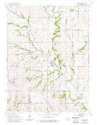
1964 Map of Emmett
USGS Topo · Published 1978About this map
Emmett and its surrounding rural townships define this 1964 survey of the Kansas prairie, updated in the late 1970s to reflect localized developments like a Powerplant and Substation. The Union Pacific railroad tracks bisect the landscape, connecting the small settlement of Aikins with the local trade center at Emmett. This transit corridor is paralleled by a dense network of watercourses, including Bartlett Creek, Cross Creek, and Bourbonais Creek, which shaped the early agricultural partitions of St Clere and Washington townships.
Find a feature on this map
29 named features on this map. Tap any name to fly to it.
Don’t see what you’re looking for? This feature index may not catch every label — zoom into the map to look around manually.
Map Details
Editions of this 1964 Emmett Map
2 editions found
Other maps of this area

1889 · Wamego
USGS Topo · 1:125,000

1889 · Topeka
USGS Topo · 1:125,000

1894 · Topeka
USGS Topo · 1:125,000

1894 · Wamego
USGS Topo · 1:125,000

1950 · Kansas City
USGS Topo · 1:250,000

1952 · Rossville
USGS Topo · 1:24,000

1953 · Belvue
USGS Topo · 1:24,000

1953 · St Marys
USGS Topo · 1:24,000

1954 · Kansas City
USGS Topo · 1:250,000

1955 · Manhattan
USGS Topo · 1:250,000