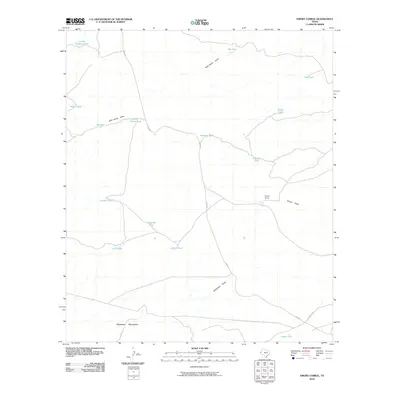
2010 Map of Emory Corral
USGS Topo · Published 2010About this map
The Emory Corral area in Culberson County is defined by a sparse network of ranching infrastructure and drainage patterns at the base of the Delaware Mountains. This arid landscape is managed through a series of namesake water catchments, including Carr Tanks, Sifford Tank, and Frijole Tank, which supported the livestock industry in this portion of West Texas. Transport is limited to rugged tracks like Chico Rd, which winds through the terrain alongside significant seasonal watercourses such as Wild Horse Draw and Emory Draw. The map captures a moment in the early 21st century where the traditional ranching heritage and geographic isolation of the Trans-Pecos remain the dominant features of the land. The presence of Budweiser Draw in the southern portion suggests local naming conventions tied to the region's cultural history.
Find a feature on this map
21 named features on this map. Tap any name to fly to it.
Don’t see what you’re looking for? This feature index may not catch every label — zoom into the map to look around manually.
Map Details
Editions of this 2010 Emory Corral Map
This is the sole edition of this map. No revisions or reprints were ever made.
Other maps of this area

1906 · Van Horn
USGS Topo · 1:125,000

1928 · Kent
USGS Topo · 1:125,000

1954 · Van Horn
USGS Topo · 1:250,000

1958 · Van Horn
USGS Topo · 1:250,000

1973 · Seven L Peak
USGS Topo · 1:24,000

1973 · K C Ranch
USGS Topo · 1:24,000

1973 · Chico Draw East
USGS Topo · 1:24,000
1973 · Delaware Ranch
USGS Topo · 1:24,000

1973 · Burro Canyon
USGS Topo · 1:24,000
1973 · Seven Heart Gap NW
USGS Topo · 1:24,000