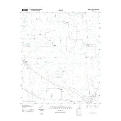
2012 Map of Emory North
USGS Topo · Published 2012About this map
Lake Fork Creek and its many tributaries, including Buckeye Branch and Turkey Creek, define the rural landscape north of the Rains County seat. Small settlements and crossroads like Richland, Dougherty, and Prospect are scattered across this terrain, connected by a dense network of farm-to-market roads and county lanes. The area is particularly rich in family-named landmarks and burial sites, which offer significant value for genealogical research. Prominent sites such as the Richland-Benton Hill Cemetery, Hill Pippin Cemetery, and Worcester-Cooper Cemetery are documented alongside local infrastructure like the Bucker Field Airport near Point. The map captures a moment of modern rural life where established family plots and historic community names persist amidst the winding waterways of the Rains Branch and Moss Wash Branch.
Find a feature on this map
103 named features on this map. Tap any name to fly to it.
Don’t see what you’re looking for? This feature index may not catch every label — zoom into the map to look around manually.
Map Details
Editions of this 2012 Emory North Map
This is the sole edition of this map. No revisions or reprints were ever made.
Other maps of this area

1953 · Texarkana
USGS Topo · 1:250,000

1956 · Texarkana
USGS Topo · 1:250,000

1956 · Tyler
USGS Topo · 1:250,000

1956 · Emory
USGS Topo · 1:62,500

1958 · Arbala
USGS Topo · 1:24,000

1958 · Alba
USGS Topo · 1:24,000

1959 · Alba
USGS Topo · 1:62,500

1962 · Lone Oak North
USGS Topo · 1:24,000

1962 · Miller Grove
USGS Topo · 1:24,000

1962 · Brashear
USGS Topo · 1:24,000