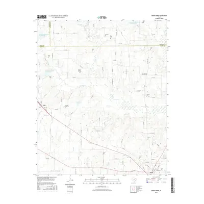
2016 Map of Emory North
USGS Topo · Published 2016About this map
Emory and the surrounding Rains County landscape are defined by an intricate network of waterways and small rural cemeteries. This 2016 survey shows the town at the intersection of local routes near Glade Cr and Brushy Cr. To the west, the settlement of Point is situated along the railroad, while the northern reaches of the quadrangle are primarily agricultural, marked by the triple junction of Hunt, Hopkins, and Rains Counties. The land is drained by Lake Fork Cr and its numerous tributaries, including Rice Br and Buckeye Br, which feed into local landmarks like Montgomery Lake and Burns Lake. For genealogists, the map is particularly valuable for its documentation of many small family and community burial grounds such as Richland-Benton Hill Cem, Worcester-Cooper Cem, and Prairie Grove Cem, scattered across the countryside between Dougherty and the county seat.
Find a feature on this map
112 named features on this map. Tap any name to fly to it.
Don’t see what you’re looking for? This feature index may not catch every label — zoom into the map to look around manually.
Map Details
Editions of this 2016 Emory North Map
This is the sole edition of this map. No revisions or reprints were ever made.
Other maps of this area

1953 · Texarkana
USGS Topo · 1:250,000

1956 · Texarkana
USGS Topo · 1:250,000

1956 · Tyler
USGS Topo · 1:250,000

1956 · Emory
USGS Topo · 1:62,500

1958 · Arbala
USGS Topo · 1:24,000

1958 · Alba
USGS Topo · 1:24,000

1959 · Alba
USGS Topo · 1:62,500

1962 · Lone Oak North
USGS Topo · 1:24,000

1962 · Miller Grove
USGS Topo · 1:24,000

1962 · Brashear
USGS Topo · 1:24,000