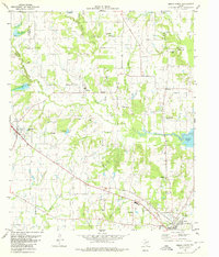
1980 Map of Emory North
USGS Topo · Published 1980About this map
Lake Fork Reservoir dominates the eastern landscape of this survey, marking a significant era of water management and local infrastructure in Rains County. The terrain is characterized by a dense network of tributaries including Turkey Creek, Lake Fork Creek, and Brushy Br, which historically shaped the placement of rural homesteads and agricultural plots. The settlement patterns are punctuated by small community centers like Point, Richland, and Dougherty, where the concentration of family burial grounds and country churches suggests a deeply rooted local history.
Find a feature on this map
50 named features on this map. Tap any name to fly to it.
Don’t see what you’re looking for? This feature index may not catch every label — zoom into the map to look around manually.
Map Details
Editions of this 1980 Emory North Map
This is the sole edition of this map. No revisions or reprints were ever made.
Other maps of this area

1953 · Texarkana
USGS Topo · 1:250,000

1956 · Texarkana
USGS Topo · 1:250,000

1956 · Tyler
USGS Topo · 1:250,000

1956 · Emory
USGS Topo · 1:62,500

1958 · Arbala
USGS Topo · 1:24,000

1958 · Alba
USGS Topo · 1:24,000

1959 · Alba
USGS Topo · 1:62,500

1962 · Lone Oak North
USGS Topo · 1:24,000

1962 · Miller Grove
USGS Topo · 1:24,000

1962 · Brashear
USGS Topo · 1:24,000