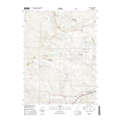
2016 Map of Empire
USGS Topo · Published 2016About this map
Empire and the surrounding mountain settlements of Alice and Saint Marys are captured in this mid-2010s survey of the high-altitude mining and recreational landscape. The map shows the complex intersection of the Continental Divide National Scenic Trail and the Continental Divide itself, which winds through peaks like James Peak, Mt Bancroft, and Mt Eva. Traces of the region's mining heritage remain visible through features such as the Glory Hole and the Silver Creek Wagon Trail, while the modern community of Downieville-Lawson-Dumont lines the valley along the Clear Creek corridor. To the north and west, the vast protected lands of the Roosevelt National Forest and Arapaho National Forest contain numerous alpine water bodies, including Loch Lomond, Fall River Reservoir, and Upper Chinns Reservoir. Genealogy researchers can identify local burials at the Empire Cem and Alvarado Cem located near the town centers.
Find a feature on this map
95 named features on this map. Tap any name to fly to it.
Don’t see what you’re looking for? This feature index may not catch every label — zoom into the map to look around manually.
Map Details
Editions of this 2016 Empire Map
This is the sole edition of this map. No revisions or reprints were ever made.
Other maps of this area

1903 · Georgetown
USGS Topo · 1:62,500

1905 · Central City
USGS Topo · 1:62,500

1905 · Georgetown
USGS Topo · 1:62,500

1910 · Central City
USGS Topo · 1:62,500

1912 · Central City
USGS Topo · 1:62,500

1924 · Montezuma
USGS Topo · 1:62,500

1924 · Fraser
USGS Topo · 1:62,500

1926 · Fraser
USGS Topo · 1:62,500

1926 · Montezuma
USGS Topo · 1:62,500

1933 · Montezuma
USGS Topo · 1:62,500